Table of Contents
India is one of the ancient civilizations of the world. During the last five decades, India has achieved multi-dimensional socio-economic progress. If we talk about size, then India is the seventh largest country in the world and according to the location, India is located between West and East Asia. The climate of India is considered tropical which is very important for India in terms of agriculture and at the same time India has shown remarkable progress in the field of industry, technology and overall economic development and is moving forward. India has also made an important contribution in the making of world history. Stay tuned with this blog for more information on this topic.

Size, Location and Neighboring Countries Of India – Indian Geography
India is the oldest civilization found in the world. India is situated between latitude 8°4’N to 37°6’N and longitudes 68°7’E to 97°25’E. India is surrounded by the Indian Ocean in the west, Arabian Sea in the south and the Bay Of Bengal in the east. The land area of India is extended upto the Tropic Of Cancer which divides India into two equal parts. It has displayed a remarkable progress in the fields of agriculture, technology, economic and industrial development and has contributed forward in the making of world history.
Some of the special features about India is as under –
– India is located in the Northern hemisphere.
– By land area wise India is the seventh-largest country in the world.
– Now India is become the number one populous country in the world.
– Politically Indian is a democratic country.
– India shares its land borders with Pakistan, China, Nepal, Bhutan, Bangladesh, and Myanmar.
– India shares its maritime border only with Sri lanka.
– Bangladesh and Pakistan share both land borders as well as maritime borders.
The important points will be discuss more in the blog so stay with the blog.
LOCATION
India is a vast country and lying entirely in the Northern hemisphere as shown in the Figure below. The main land of India extends between latitudes 8°4’N to 37°6’N and longitudes 68°7’E to 97°25’E. The Tropic of Cancer (23° 30’N) divides the country into almost two equal half’s. The Andaman and Nicobar islands and the Lakshadweep islands in Bay of Bengal and Arabian Sea respectively as the part of the mainland of the southeast and southwest. Now it is time to take out your atlas and find out the extent of these groups of islands or we will discuss in other blog based on the topic
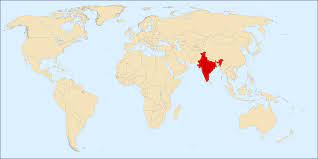
Size of India on world map
If we talk about the measurement of extreme latitude from north to south, it is approximately 3,214 km and the measurement of extreme longitude from east to west is approximately 2,933 km. The total land area of India is 3.29 million sq km. If we talk about the total geographical area of the world, then India owns about 2.4 percent. It should be remembered here that India ranks seventh in the list of countries with the largest land ownership. India has a total land border of about 15,200 km and a total length of mainland coastline including Andaman and Nicobar and Lakshadweep is 7,516 km.

The north, north-west and north-east regions of India are surrounded by valleys, valleys and mountains. The landmass of India starts shrinking to about 22° south of the northern latitude and then extends in a southerly direction towards the Indian Ocean. For this reason, it divides the sea into two parts, the Arabian Sea in the west and the Bay of Bengal in the east.
The latitudinal and longitudinal extent of the main land of India is about 30°, but despite this fact, India’s east-west extent appears to be smaller than the north-south extent of India. India’s north-south extent is 3214 km and east-west extent is 2933 km. But the distance between any two meridians is maximum at the equator and decreases as one moves from the equator towards the poles.
Uniformity in India’s time system
Measuring time in India according to the Standard Time Meridian, there is a difference in time in different parts of the country, such as there is a time difference of two hours from Gujarat to Arunachal Pradesh. Therefore, to bring uniformity in the time system in India, the standard meridian of India (82°30’E) passing through the city of Mirzapur in the state of Uttar Pradesh is taken as the standard time for the whole country. The latitudinal range affects the duration of day and night as one moves from south to north.
India’s position and the world
If we talk about the location of the land of India then we find that the land of India is situated at a central place between the east and west of the Asian continent and India is an extension towards the south in the Asian continent. If we talk about the route of maritime transport so India has a strategic central position especially for the trans Indian Ocean sea route, which plays an important role in connecting western countries to countries in East Asia. Worth noting here is that the Deccan Peninsula’s spread over the Indian Ocean helped India establish close contact with West Asia, Africa and Europe from its west coast and with South East and East Asia from its east coast and it is also worth noting that no other country has the longest coastline on the Indian Ocean as India. Thus gives India a prestigious position in the Indian Ocean. It would not be untrue to say here that the name of the Indian Ocean has been named after India.
It is not untrue that India’s contacts with the other countries of the world have continued through ages and it is also found that the relationships through the land routes are much older than her maritime contacts. It is also found that the various passes across the mountains in the north have provided passages to the ancient travelers too.
These land routes have played a remarkable role in the exchange of ideas and commodities since ancient times. There is the evidences found that the ideas of the Indian numerals and the decimal system, the Upanishads and the stories of Panchtantra could reach in the many parts of the world through these land route. The spices, muslin and other merchandise were taken from India to different countries shows the good contacts with other countries of the world. On the other hand it is also seen the influence of Greek sculpture and the architectural styles of dome and minarets from West Asia in different parts of our country.
India and their Neighbours
India is a country of 28 states and eight union territories and India also occupies an important strategic position in South Asia region. India is surrounded by nine neighboring countries and shares their land borders as well as maritime borders. In the northwest area the land border shares with Pakistan and Afghanistan, in the north area the land border shares with China (Tibet), Nepal and Bhutan and Myanmar and Bangladesh shares the boundaries in the east. In the southern region two island countries namely Sri Lanka and the Maldives shares our maritime boundary.
The boundaries of India and Sri Lanka is separated by a narrow channel of sea formed by the Palk Strait and the Gulf of Mannar and the Maldive Islands lie to the south of the Lakshadweep Islands. India has strong geographical and historical ties with their neighbours and always take efforts to maintain peace.
How India stands apart from the rest of Asia ?
India is the 7th largest country in the world. Population wise India is became number one in the world. India shares its in the northwest land boundaries with Pakistan and Afghanistan, northern boundaries with China (Tibet), Nepal and Bhutan and eastern boundaries with Myanmar and Bangladesh and shares its maritime boundaries with Sri lanka and Maldavies. India stands apart from the rest of Asia with the Himalayas acting as a natural barrier to the north and northwest and the Purvanchals in the northeast.

Frequently asked questions
Question – As per the evidence proved that is the Indian civilization the oldest in the world ?
Answer – Yes
Question – Is it true that India is situated between latitude 8°4’N to 37°6’N and longitudes 68°7’E to 97°25’E ?
Answer – True
Question – India is surrounded by which of the ocean alongwith the Bay of Bengal ?
Answer – India is surrounded alongwith the Bay Of Bengal by the Indian Ocean and Arabian Sea.
Question – India is located in which of the following hemisphere?
Answer – India is located in the Northern hemisphere.
Question – What is the number of India as land area wise in the world.?
Answer – land area wise India is the seventh-largest country in the world.
Question – What is the number of India as per the population wise in the world.?
Answer – As per the population wise India become the number one country in the world.
Question – How many countries does the India shares their border ?
Answer – There are nine countries from which the India shares their border.
Question – What are name of the seven countries who share the border?
Answer – They are Afghanistan, Bangladesh, Bhutan, China, Maldives, Myanmar, Nepal, Pakistan, and Sri Lanka
Question – Which of the countries who share the maritime border with India ?
Answer – Sri lanka and Maldives.
Question – Is there any country among the seven countries who share their land border as well as maritime border with India?
Answer – They are Pakistan and Bangladesh.
Question – Why is the latitudinal and longitudinal extent of India 30 degrees?
Answer – Since India lies above the equator, an extent of 30 degrees by longitudes gives a lesser extent in terms of breadth
.